
Identified as a top priority during the development of the District’s Parks Master Plan, this portion of trail was the first phase of over two miles of planned trails to provide connectivity and recreation for District residents.
EHRA was selected by the client to provide engineering design and to serve as District Engineer for the 2,400 acre Towne Lake Development. Our survey department retraced the overall boundary and performed a topographic survey of the site.
EHRA completed a site-specific planning and visioning study for the proposed 470-acre San Jacinto Boulevard District (SJBD) in Baytown, Texas.
EHRA assisted with the district creation of Montgomery County Municipal Utility District No. 126 to accommodate a ±329 acre master planned community located in northern Montgomery County in the City of Conroe, south of League Line Road, west of Longmire Road, and adjacent to Lake Conroe.
Facilities requiring expansion were also common wall construction, and the EHRA team converted the facilities into aerobic digesters and sludge thickeners.
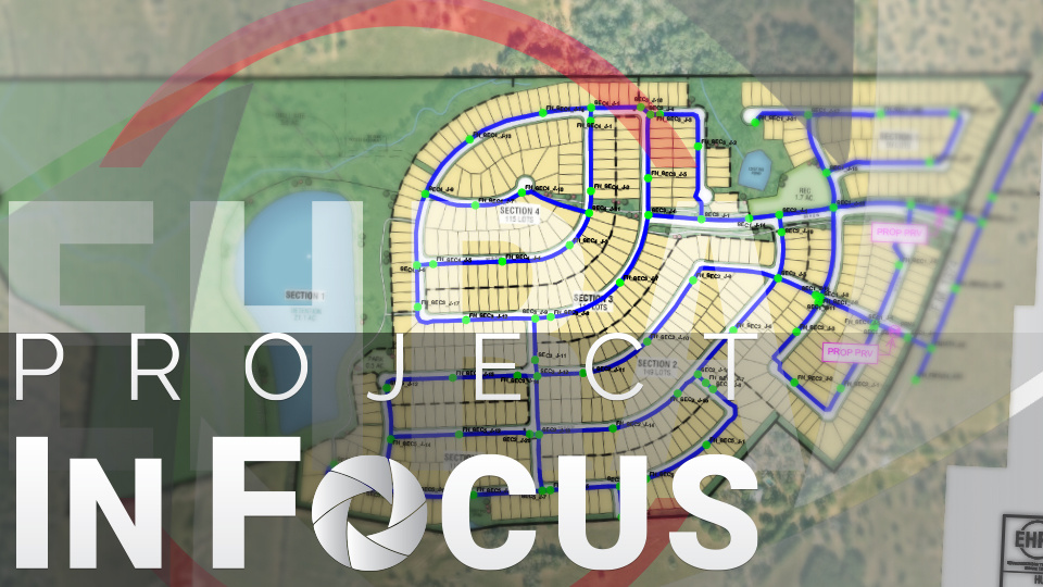
Sweetwood is a future ± 226.5-acre master planned community in Huntsville MUD 2 near the City of Huntsville in Walker County, Texas. This Forestar Group Development will predominantly consist of residential lots, situated on a site with over 80 feet of elevation change in topography. The community is planned to be served by a 12-inch interconnect with the City of Huntsville, located at the intersection of Veterans Memorial Parkway and Montgomery Road.
EHRA Engineering modeled the distribution network for the Sweetwood development, the off-site water line extension and interconnection with the City of Huntsville. The model assessed the ability of the City of Huntsville to provide water to the Sweetwood development and determined any impacts of the elevation changes to the distribution network design. The off-site waterline would run approximately 1,500 feet from the interconnection point to Sweetwood along Montgomery Rd/FM 1374.
EHRA created a detailed model to simulate water system performance under normal and fireflow conditions, using Texas Commission on Environmental Quality (TCEQ) guidelines. A fireflow test measured the city’s water distribution system, revealing fire hydrant pressures between 78 and 90 psi. Based on these findings, the upstream water supply was calibrated to 70 psi in the model, achieving a close alignment—within 3%—with real-world conditions.
EHRA assessed distribution pressures throughout the development and proposed tailored solutions. This included the unique implementation of Pressure Reducing Valves (PRVs) to regulate pressure within the distribution system. EHRA determined the best locations and settings for the PRVs and the ideal pipe sizes for both on-site and off-site waterlines. To accomplish these goals, EHRA created a distribution network in AutoCAD using H2ONet, a specialized modeling software. This program is used to model and simulate the behavior of water distribution systems. It can simulate the flow of water in reservoirs, tanks and pipes, and helps in determining factors such as pressure, velocity and flow rate within a hydraulic network.
The proposed development/distribution system will use PVC pipes, and model settings were adjusted in order to match PVC piping characteristics, as recommended by the American Water Works Association. The model includes pipes of various sizes and nodes representing intersections, fire hydrants and water demand. The elevation of each node was carefully set based on topographical surveys and design data, ensuring that the modeled pressures accurately reflect real conditions at ground level. Demand from the system (representative of normal residential water uses, including toilets, showers, faucets etc.) was modeled in terms of Equivalent Single Family Connections (ESFCs). Each lot was counted as 1 ESFC.
The interconnect with the city’s water system was modeled as a reservoir (represented by the natural ground elevation at the interconnection point plus the pressure coming from the city’s water system of 70 psi). Maximum daily demand was set at 1.5 gpm/ESFC, while low demand was modeled at 0.1 gpm/ESFC to estimate minimum and maximum pressures, respectively, within the development. For emergency conditions, fireflow demand was set at 1,500 gpm per NFPA standards.
The analysis guided infrastructure planning to ensure a reliable water supply under all conditions. EHRA recommended placing PRVs with settings of 45 psi at both waterline entries and two additional PRVs set at 55 psi along Montgomery Rd/FM 1374 to mitigate pressures exceeding 80 psi caused by elevation changes. These high pressures could risk leaks or blowouts in residential fixtures. Additionally, appropriate waterline sizing was proposed to maintain compliance with pressure regulations. The 12-inch interconnect was found to maintain pressures above 35 psi during normal maximum daily demand and above 20 psi during fireflow conditions with a city supply pressure of 70 psi. EHRA Engineering is proud to be a trusted partner to both the Forestar Group and Huntsville MUD 2 in the Sweetwood master-planned community, contributing innovative solutions to ensure a reliable and efficient water distribution system for all future residents.
