
EHRA’s Planning & Visioning (P&V) practice area primarily serves our developer clients, specializing in Master Planned Community (MPC) design. In the most basic terms, this includes choice of land use, orientation of streets and design of residential lots. However, since EHRA is a multi-disciplinary civil engineering firm, our MPC designs are guided and realized by the integration of our other practice areas including Hydrology and Hydraulics, Landscape Architecture and of course, our Land Development Engineers. We are proud of our ability to provide full-service land development services for our client partners.
Perhaps not as well-known is that EHRA’s P&V Team uses its experience with MPC design to provide insight into future development strategies for municipalities. We have worked with cities, counties and Tax Increment Reinvestment Zones (TIRZ) as planning consultants on transportation plans, growth plans, and also worked on ordinance creation. The combination of such planning studies is called Comprehensive Planning which is a service we are currently providing for the City of Pattison and the Village of Fairchilds.
Comprehensive plans are adopted by governments to plan for the future of their communities, often in 10 to 20-year increments. Predicting any further into the future is not only difficult, but results in wildly inaccurate predictions. In fact, it is recommended that comprehensive plans be revisited at a regular interval, for instance every five years, so that the plans reflect current development forces and economic conditions. For example, comprehensive plans inform cities where future budget money should be directed, propose thoroughfare and local street enhancements, recommend changes to ordinances and highlight needs for municipal facilities such as parks, police and emergency services. These and other factors are described in text and graphics in a document that is adopted by councils as a planning guide.
Once complete, comprehensive plans provide city officials the data and pre-planning to decide where and when to spend their resources. Projects and funding are recommended in a priority list, organized in a manner fitting the budget capabilities of a city, or prioritized to yield the greatest impact and generate community excitement. Comprehensive plans show agencies like TxDOT or grant funding entities that a city is serious about its future.
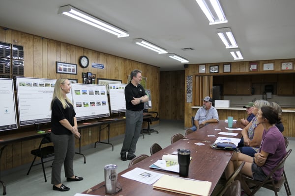
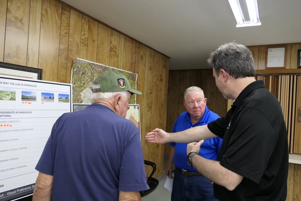
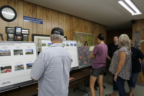
Similar to how EHRA’s P&V Team approaches new MPC’s, comprehensive plans are documents created after study of current land use, transportation, drainage and floodplains, public infrastructure and economic and social determinants, among many other criteria. Understanding a community’s current conditions is necessary before any analysis or public meetings are conducted. We hold multiple public outreach meetings as needed to fully understand what communities see for themselves, allowing them to describe their own future. Then by applying our planning expertise, we can propose scenarios and recommend strategies to account for future growth.
An important consideration as to why a city, county, or TIRZ should take on comprehensive planning is that development is coming no matter what. Availability, flood regulations and cost of land have pushed new MPC’s farther from Houston’s regional center for decades. The proof is in the three freeway rings in our region. 50 years ago, Loop 610 was the edge of the city and small towns lay around the periphery. 25 years ago, Beltway 8 served as the edge of development and the small towns became part of the fabric of the Greater Houston area. Today, the Grand Parkway has spurred new development in every outlying county. Once the final sections are completed in Fort Bend and Brazoria counties, the small communities along the alignment will experience the same growth forces currently faced by areas near Katy, Tomball and New Caney. This trend will not change. Outlying farming communities that were once considered “too far out” are now considered prime real estate.
Newly passed state laws have further complicated the ability of cities to govern in their ETJ’s, in essence limiting their influence and effectiveness of their laws to what is located only within city limits. The State of Texas has made it easier for landowners and developers to de-annex from ETJ’s but also made land regulated by counties immune to minimum lot size regulation. Simply stated, if a developer wants to build a new community near a small city, so long as they are providing water and wastewater service, they can create lots of any size they desire. This fact is often at odds with small communities that historically have been accustomed to large acreage lots and very low population density. New development can stress small communities which do not have the public infrastructure, police protection or regulatory finesse to regulate new development.
So how does a small community protect a historical way of life and rural community feel while allowing inevitable development to occur? EHRA’s Planning and Visioning team has written many comprehensive plans to address these development issues and make custom recommendations based on analyzed data and personal reservations from the community’s public. There is no “one size fits all” approach to comprehensive planning despite all small communities surrounding Houston being faced with similar development trends.
Some might be fearful that their roads may become overwhelmed, or their night skies polluted as development occurs. Comprehensive plans provide explanation of pros and cons so that small cities and new development can coexist. EHRA takes ownership in preserving and protecting the character of those communities while unmasking the benefits of improved public infrastructure and services that they truly need.
In conclusion, while change in development may appear intimidating, the benefits far outweigh the initial fears and concerns. By embracing and properly planning for growth, we move forward towards resilient, purposeful and ultimately, positive infrastructure. It is our job as EHRA planners and engineers to unlock the endless possibilities of custom betterment to all communities, both big and small, all around us.

Categories
